Chai Nat, Thailand – The Chao Phraya River Basin is experiencing critical flooding as high water discharge from the Chao Phraya Dam in Chai Nat Province continues to impact downstream communities. For the fourth consecutive day, dam discharge has been maintained at 2,900 cubic metres per second, causing severe flooding in Sapphaya district.
In Bang Luang Subdistrict, a temporary 4-kilometre embankment made of crushed rock collapsed at two points, sending floodwaters rushing into over 400 households. Water levels in the affected areas range from 50 centimetres to nearly 2 metres, forcing residents to navigate their homes by wading through water.
Sirin Phatsorn, a local resident, described the scene: “We’re in real hardship now. Cars cannot pass, and we have to wade to our homes. The municipality warned us to move belongings to higher ground, but the water rose fast once the dam increased discharge.”
At Station C2 in Nakhon Sawan, water flow was recorded at 2,976 cubic metres per second, with upstream levels at 17.50 metres and downstream levels at 16.67 metres, 33 centimetres above the riverbank. Authorities continue to monitor the situation closely and maintain controlled dam discharge to mitigate further damage.
Meanwhile, Bangkok faced its own flooding crisis due to heavy rainfall, affecting 57 locations across the city. Key areas impacted include Rama 4, Rama 3, Khlong Toei, Ratchadaphisek, Phachathipak, and Sala Daeng. Pathum Wan District recorded the highest rainfall at 111 mm, followed by Ratchathewi (97 mm) and Pom Prap Sattru Phai (92 mm).
Governor Chadchart Sittipunt confirmed that the city’s flooding was caused solely by intense rainfall and was not connected to upstream water from the Chao Phraya River. Drainage systems and pumping stations are operating at full capacity, and teams have been deployed to clear debris and blockages that delayed water flow.
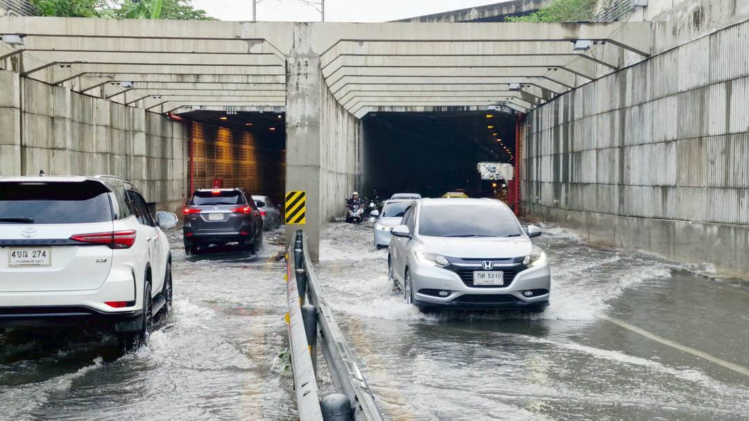
Bang Sue Tunnel Update: Floodwater inside the tunnel is approximately 5 cm, with the pumping system still running continuously. Traffic is open in both directions, but motorists are advised to drive carefully.
The governor also visited Ratchadaphisek Road and Ratchayothin Tunnel, where water levels had receded, with minor retention remaining in some lanes. Long-term flood prevention measures, including a new drainage system linking Ratchadaphisek Road to Khlong Lat Phrao, are expected to be completed in 2026.
Authorities urge residents in both Chai Nat and Bangkok to remain vigilant, follow official guidance, and take precautions as water levels continue to fluctuate.